Hot Cities, Methane Leakers and the Catholic Church
Guests
Ariane Middel
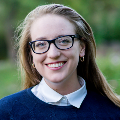
Molly Burhans
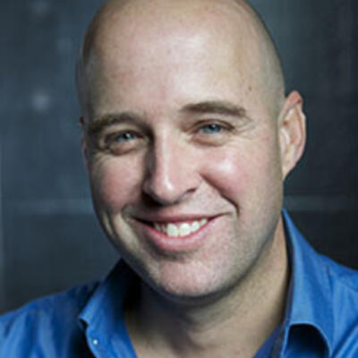
Riley Duren
Summary
In 2017, it got so hot in Phoenix that airplanes literally could not take off, and airlines cancelled dozens of flights. Extreme heat is likely to become more common, and last longer, as climate disruption continues.
The National Oceanic and Atmospheric Administration recently released an updated set of so-called "climate normals" – averages it compiles every decade. And to no one’s surprise, they showed that our world has gotten warmer.
“Heat is really a silent threat. You can’t really see it. So it’s different from your hurricane or flooding or tsunami where you immediately see the impact,” says Ariane Middel, an associate professor at Arizona State University and Senior Scientist with the Global Institute of Sustainability and Innovation. She studies extreme heat on the local level.
She uses a robotic weather station named MaRTy to measure how shade and different urban and landscaping designs may affect people’s actual heat experience. Middel says that localized information is essential to keeping places like Phoenix livable into the future.
“As these conditions become more harsh and more extreme, we have to make sure that people can still be active outdoors. And in order to achieve this, we have to come up with urban design strategies and interventions that can protect people from the heat.”
Middel says cities can use data like hers to target interventions like shade or cooling stations in neighborhoods where people need them the most.
Mapping has other applications, too. The Roman Catholic Church is one of the largest landholders in the world. In 2016, a young Catholic geographer named Molly Burhans approached the Vatican about using advanced software to map the lands under Catholic ownership as a starting point for climate action. Burhans, founder and executive director of the nonprofit Goodlands, says she realized the Church had power to affect positive change through land stewardship.
“I think any belief system – Catholic, Muslim, agnosticism, humanism – we all share I think a common core value of helping others in need and helping our communities flourish and a desire for the world to flourish. And I saw that land and the environment is the multiplier of every single one of these missions,” Burhans says.
Burhans uses powerful mapping data tools known as geographic information systems (G.I.S.) to help dioceses better understand their lands and connect them with local conservation organizations.
Another project, Carbon Mapper, uses satellites to identify emitters of both CO2 and methane in real time with the goal of reducing emissions. Carbon Mapper CEO Riley Duren says many companies or operators don’t track their methane emissions because it’s complicated and expensive, and there aren’t many regulations requiring it. For now his group is working with a “coalition of the motivated,” which Duren says tend to be larger oil and gas or waste management companies with decarbonization targets. But he’s seen that across different industries people are anticipating more in terms of future regulation and trying to get ahead of it.
"There is still an opportunity to bend the curve on emissions and avoid the worst-case scenarios, but that window is rapidly closing,” Duren says. “We will not solve everything with greenhouse gas monitoring but we perceive that Carbon Mapper, with this unique partnership, will help fill some critical gaps and it will do it quickly.”
Related Links:
ASU SHaDE Lab
Goodlands
Carbon Mapper
NOAA "climate normals"
Have you ever had a difficult conversation about climate? A disagreement, perhaps, or coming to terms with a new reality? We’d like to hear your stories. Please call (650) 382-3869 and leave us a voicemail about your toughest climate conversation. Or drop us a line at climateone@gmail.com. We may use your story in an upcoming episode.
Full Transcript
Greg Dalton: This is Climate One. I’m Greg Dalton. How can data help us respond to the climate emergency?
Riley Duren: There’s still an opportunity to bend the curve on emissions and avoid the worst-case scenarios, but that window is rapidly closing.
Greg Dalton: The Catholic Church is one of the largest landholders in the world. One effort is mapping their lands to work toward climate solutions.
Molly Burhans: You know the last thing you want is another cool tech platform that doesn’t get anything done. (laughs) But rather helps people who already are committed and intelligent to get more information that will help them continue to make better decisions.
Greg Dalton: And what are the benefits of mapping heat on a very local level?
Ariane Middel: So it’s really important not just to look at a city and say, okay this will be the temperature 30 years from now but you have to really know neighborhood by neighborhood what’s going on so you can really target your interventions and help the neighborhoods that are most in need.
Greg Dalton: Mapping carbon emissions, extreme heat, and Catholic landholdings. Up next on Climate One.
Greg Dalton: What’s the value of maps and data when it comes to combating our climate crisis? Climate One’s empowering conversations explore all aspects of the climate emergency. I’m Greg Dalton.
Greg Dalton: The National Oceanic and Atmospheric Administration recently released an updated set of so-called “climate normals” -- averages it compiles every decade. And to no one’s surprise, they showed that our world has gotten warmer. In 2017, it got so hot in Phoenix that airplanes literally could not take off, and airlines cancelled dozens of flights. Ariane Middel [air-ee-ah-nah mi-DELL] is an associate professor at Arizona State University and Senior Scientist with the Global Institute of Sustainability and Innovation. She studies extreme heat on the local level.
Ariane Middel: Last year, I think we broke every record in the books. We’ve had over 144 I think days of 100 degrees. We had 53 days over 110. So, it was fairly hot here in Phoenix. It’s really an ideal place to study heat it’s like a living laboratory.
Greg Dalton: You’re in the right place. And what are the factors that affect how humans experience heat on the local level? Like what determines the kind of micro factors on a particular block in a particular neighborhood?
Ariane Middel: The factor that most influence is how we actually experience heat when we’re outdoors is the direct sunlight. So, it’s the radiation that hits our bodies from the direct sunlight, the shortwave radiation. And there’s a concept called mean radiant temperature which is slightly different from air temperature. So, you’re probably familiar with air temperature, that's a temperature that you get from your weather forecast, but mean radiant temperature is more. So, mean radiant temperature is the radiation that hits the body from 360 degrees from all directions. So, it’s the shortwave radiation that comes from the sun that’s the direct sunlight, the visible sunlight, the UVB. But it’s also the longwave radiation which is essentially the heat that gets emitted from hot surfaces. So, imagine you’re standing on top of the asphalt parking lot and the asphalt parking lot has been sun exposed for most of the day. So, that heat gets stored in the asphalt and slowly radiates back at your body. And so, mean radiant temperature incorporates all of this. The longwave and shortwave radiation and it’s a good measure of how you actually feel when you’re standing outside in the sun.
Greg Dalton: Right. And you talk about asphalt absorbing heat and then releasing it. We hear a lot about urban heat islands. Can you explain what they are and why they are problem for people living in cities?
Ariane Middel: Urban heat island is a big problem because it causes temperatures to be warmer at night. And that’s because as we build cities, we bring in all these artificial materials into the city. We have to build infrastructure, roads, sidewalks. They consist of concrete and asphalt. And those materials are really great at storing the heat during the day. They have a very high thermal admittance. So, that means as the sun hits those surfaces during the day they heat up and they store the heat like a sponge. And then as the sun goes down, the surface slowly releases the heat back into the atmosphere which makes the city warmer at night than it would be if we didn’t have these artificial surfaces.
Greg Dalton: Wow. So, just when people are looking for relief and cooling off in the evening their driveway and the parking lot is releasing more heat. Heat is a leading cause of weather-related deaths in the country, what are the human health impacts of excessive heat?
Ariane Middel: Heat is really a silent threat. You can’t really see it. So, it’s different from your hurricane or flooding or tsunami where you immediately see the impact. So, heat is a silent killer. So, as it’s hot in the summer and the stress on the human body accumulates over time, people get more and more stress and this causes in the long-term morbidity and mortality in regions that are hot. But there’s also the small things like you would like to walk your dog in the middle of the day and it’s just too hot and you get sun burned. And it’s just really an aspect of life that affects everyone here in Phoenix during the day.
Greg Dalton: I was speaking to a urologist recently and he said, yeah, we see more kidney problems during heat waves, because people get dehydrated. That was a new one to me. I'm constantly thinking I think I've heard a lot of all the climate impacts but airplanes can’t take off and kidney problems during heat waves was a new one to me. Do some groups feel the health impacts more than others, elderly, children, etc. who's more vulnerable?
Ariane Middel: There’s definitely an unequal distribution in the impacts of heat. So, people like you and me who can afford to run their air-conditioning we’re probably fine most of the summer. But people who cannot afford to run their air-conditioning 24/7, people who don't have a lot of money, people who are older, who maybe don't notice the heat as much as you get older your body kind of loses its ability to detect these heat stress situations. So, those folks are much more vulnerable than your average person.
Greg Dalton: Right, that’s on the individual level. It’s well-established wealthy neighborhoods have more trees and shade. I understand your research is focused on technically measuring heat in different ways. But if you look at the literature and the research of others. Is there a correlation between race and class and the impacts of heat on people in cities?
Ariane Middel: There is definitely a correlation between the heat distribution in a city and the demographics and the socioeconomics in a city. What we see frequently is that neighborhoods that have lower income families also have less trees, they are hotter. If you look at surface temperature maps you see that those neighborhoods are really hotter during the day and at night than neighborhoods that have more trees that are wealthier. And that’s a common pattern in many cities around the world.
Greg Dalton: And as I was reading about your work I thought, gee, how long is it before some of the websites that incorporate property data and, you know, this house is in a good school district and its access to walkable school. And I thought about, well, how long is it gonna be before your data is incorporated into those websites so that people can know how hot it's going to be if they buy this house, is that happening?
Ariane Middel: I wonder why people haven’t done this yet actually. Because the data exist so there are satellite images that show you the heat distribution in cities and it would be fairly easy to intersect that information with housing data and add a heat safety score to your neighborhood.
Greg Dalton: Right. Some desert cities like Tucson have adopted goals for tree planting to help reduce the urban heat affects. Do you think that makes a difference that specific goals for planting trees?
Ariane Middel: I think that setting these targets is important to get something done, to have a goal, to have an aim. But broadly increasing the tree canopy cover to a random percentage of more trees is not necessarily helping because trees have a very localized impact. So, it’s really important to do targeted interventions and plant those trees where people actually walk where people exercise where people are outdoors so that those trees have the maximum benefit.
Greg Dalton: You were involved in a report titled 50 Grades of Shade that measure the effectiveness of trees and engineered shade. What do you think cities and residents should do to provide the most effective shelter from rising heat?
Ariane Middel: There are many ways to provide shade. Cities frequently experience these infrastructure challenges where they have a location where they would really like to plant a tree, say, a bus stop for example. But then there are these sewer lines or power lines in the way businesses can claim that people can’t read their signage. So, in this 50 Grades of Shade study, we looked at shade alternatives to see if there are any other viable types of shade that could be used in those situations. And what we found is that generally any shade is great. So, no matter what type of shade you use you’re really reducing the heat stress and the heat load on a person’s body. But engineered shade types such as shade sails structural shade from awnings, overhangs can be as effective or even more effective than a tree. And they may not require a lot of irrigation or maintenance such as trees. So, there are certain benefits to engineered shade type as well.
Greg Dalton: Tell me about MaRTy your robot.
Ariane Middel: MaRTy is a mobile weather station that can measure how you experience heat. So, it measures the heat load on a human body. It has three net radiometers and they look a little bit like Wall-E. So, when we go out measuring with MaRTy we’ve frequently get asked, so is this a Mars rover, is this Wall-E, what are you doing here? So, MaRTy can measure the radiation or the mean radiant temperature that hits the body from all directions. And we can pull MaRTy literally anywhere.
Greg Dalton: And what’s the benefit of mapping heat on that level. What can we learn from that data?
Ariane Middel: Mapping heat using MaRTy is a very human-centric approach because MaRTy, you can think of him as a human, right. So, MaRTy can go where humans can go. MaRTy has the same height same size approximately as a human. MaRTy really measures how we feel the heat as opposed to just the air temperature that we get from the weather forecast. So, that’s why MaRTy is really great in measuring shade and the impact of different urban designs, different landscaping and how people actually experience the heat.
Greg Dalton: And what are some of the real-world implications of this research?
Ariane Middel: It is projected that Phoenix will break many, many more heat records in the near future. So, conditions anywhere in the world will just get more extreme, heatwaves will last longer, they will be hotter and they will occur more frequently. And as these conditions become more harsh and more extreme, we have to make sure that people can still be active outdoors. And in order to achieve this, we have to come up with urban design strategies and interventions that can protect people from the heat.
Greg Dalton: I flew into Portland, Oregon a while back and saw a sea of white roof, as the airplane was ascending. Why aren’t white roofs the norm, especially in hot regions it seems so simple and cost-effective?
Ariane Middel: That’s a good question. Painting roofs white works in a way that the energy that comes from the sun is actually reflected back into the atmosphere as opposed to being stored inside the roof. Because the roof is similar to the asphalt and concrete has a very high thermal admittance it’s really great at storing the heat during the day and releasing it at night. So, if you paint a roof white or with a highly reflective paint, it can stay cool during the day it’s not going to heat up as much so that will reduce your urban heat island. It’s a very effective way of cooling an urban area and we have plenty of roofs available.
Greg Dalton: Right. And I also saw something on your website about painting sidewalks to reflect heat. That was a new one. Is that effective and is that happening?
Ariane Middel: The city of Phoenix last year started a pilot project where they painted roads in age district neighborhoods with a highly reflective paint. It’s a type of coating that increases the reflections so as the sun hits the asphalt, the energy is going to be reflected back into the atmosphere as opposed to being stored in the road which makes the road stay cooler to the touch during the day and also then reduces the urban heat island at night. In terms of the results, it definitely reduces the actual surface temperature of the road up to 10, 16 degrees Fahrenheit. So, it was actually fairly sizable.
Greg Dalton: Right so we may see white roads instead of black roads in the future. How do you see localized mapping fitting in with larger mapping of climate impacts?
Ariane Middel: I think local mapping is really important because resources for heat interventions are limited. Cities don’t have those amounts of money to plant trees and to provide shade. So, producing these localize maps help cities actually plan those interventions and find areas that are in the most need for these interventions. So, it’s really important to not just look at a city and say, okay so this is gonna be the temperature in 30 years from now but you have to really know neighborhood by neighborhood what’s going on so that you can really target your interventions and help the neighborhoods that are most in need.
Greg Dalton: We also talk about the cultural adaptation. I lived in China and other places in Asia where people just carry around umbrellas for heat, something we don't really see in the United States. I’m curious about the kind of the human adaptation. We’ve been talking about planting trees and building overhangs and shelter and that sort of thing. I know this maybe on the edge you’re focusing on your robot and I don’t know if your robot is going to go around with an umbrella maybe not.
Ariane Middel: Well, actually we had jokingly we had planned a study called MaRTy Poppins where we wanted to investigate the effectiveness of different types of umbrellas. And put different types of umbrellas in top of MaRTy and see how he feels. So, that’s definitely something that’s on our research agenda.
Greg Dalton: Right, okay. MaRTy Poppins I like it. So, on a personal level do you think heat will ever cause you to move away from Arizona are you so excited to stay there and study it as it rises and rises?
Ariane Middel: I’m actually tired of rain. I'm from Germany so I’m actually perfectly desert adapted and perfectly happy in the heat. So, I don’t think there will be a point in time where I will be moving away from Arizona because of the heat. But I could see that other people might make other choices and this might be a consideration for some to as summers get hotter and hotter and we have more and more 110-degree days.
Greg Dalton: Yeah, internal climate migration is already starting to happen in the United States. Ariane Middel, thanks for coming on Climate One.
Ariane Middel: Thank you so much for having me. It was fun.
Greg Dalton: Ariane Middel is an associate professor at Arizona State University studying extreme heat. You’re listening to a Climate One conversation about the power of data to respond to the climate crisis. Coming up, we hear about an effort to map the landholdings of the Catholic Church to find opportunities for climate and environmental solutions:
Molly Burhans: It’s been, not just a massive digital development effort but a massive storytelling effort for communities, walking them through getting excited about this.
Greg Dalton: That’s up next, when Climate One continues.
Greg Dalton: This is Climate One. I’m Greg Dalton, and we’re talking about how mapping at the local, regional and global level can help humanity respond to the climate emergency.
I’ve been hosting and producing this show for 14 years, most of that time booking and interviewing guests on my own. Happily, our team is growing, and we’re starting to include more voices on the show. One of those is producer Ariana Brocious, who now also edits the program. She’ll be a regular voice on Climate One going forward. Today, Ariana talks with a young Catholic geographer who is founder and executive director of the nonprofit organization, Goodlands. Molly Burhans approached the Vatican in 2016 about using advanced software to map the lands under Catholic ownership as a starting point for climate action.
Ariana Brocious: You’re a Catholic and a cartographer. What inspired you to look to your religion as an avenue for combating climate change?
Molly Burhans: Initially I was really looking at land-use and regenerative agriculture as a whole. Climate change being that critical piece of you know the kind of systemic environmental problems we’re facing, including biodiversity loss and habitat destruction as well. And I was considering becoming a nun and I had met these really cool nuns. There are really cool nuns. And I noticed that their land management at the large motherhouse was, you know, there are erosion issues, invasive species and I, at the time had cofounded my first company which is Grooperative the worker owned cooperative in Buffalo which is one that is indoor vertical farming company. And, you know, I thought wow like before I do this, you know, what could I bring to this community would be that, you know, sustainable land management including regenerative agriculture because I realize it was just a multiplier for every single mission, you know. I think any belief system whether it's, you know, Catholic, Muslim, even, you know, agnosticism, humanism, we all share I think a common core value of helping others in need and helping our communities flourish and a desire for the world to flourish. And I saw that land and the environment is the multiplier of every single one of these missions. It was just kind of seeing that oh wow, we’re like collectively as a network the largest land total in the world and there’s no one really doing this and like everything we do would benefit from sustainable and management.
Ariana Brocious: Right. So, for those who don’t know, what’s the Laudato Si’?
Molly Burhans: Laudato Si’ was Pope Francis’ encyclical on the environment, this document. And it is an absolutely, if you haven’t read it, I completely just recommend checking it out. It interweaves spirituality and science with the Catholic faith and with climate change. And also, at the end there is an invitation of prayer for the faithful. There's one, also he has one included ford everyone also who is reading the document who you know from whatever perspective they are because he really shows how within that document, he beautifully shows I think how this is a problem for all of us right now and we need everyone to work together.
Ariana Brocious: And how influential is that document on you and the work you do?
Molly Burhans: You know before that I was really into environmentalism. I mean my parents, you know, I grew up in a house that was like part of the Sierra Club and like we always spend time in nature growing up as a kid and my parents are scientists and like. Yeah, so I always have this deep-seated just love and celebration of nature. So, I guess, you know, the nonfarm thing kind of was way before Laudato Si’ that was like a couple years two years before. So, it was like kind of moving, you know, before that. I think Laudato Si’ really helped create the energy for the larger vision. I wasn't afraid to like you know to be Catholic and be in the public sphere and be doing this and like to be a totally imperfect human who is a work in progress, which I shouldn’t have been afraid of in the first place. But you know, I guess I was kind of like young and you know everyone when you do something big there is kind of you know it take some courage.
Ariana Brocious: Absolutely. Well, I have this remarkable story of approaching the Vatican as a 26-year old to learn more about the landholdings of the Catholic Church. And can you take back to that moment like what motivated you to try to meet directly with the Vatican. What was your mission and your goal at that point?
Molly Burhans: So, I wanted to start with a global vision of classifying dioceses. I knew that if we were going to say work with researchers’ algorithms for say stormwater management or certain you know types of understanding different foliage patterns and habitat patterns in an area. I want to be able to classify every diocese in the world that we could scale the application of these algorithms that were used to analyze the environmental, social and financial kind of landscape of a property portfolio within whichever jurisdiction it was. And also, to be able to classify dioceses to see if they were like a map that we made is like where the Catholic Church is the most important non state actor for biodiversity preservation. Which areas are really highlighted risks for climate migration, immigration or emigration. And those are areas where I see like our work being maybe less like oh yeah, we’re gonna do conservation here and focus on even though that's critical on those places. But I think like in emergency situations it’s more about okay, land use how can we get this data how can we work with people to get it to like Jesuit refugees services or somebody else who can help prevent informal settlements which can be really damaging to the environment and address immediate needs. So, that’s how I ended up in the Vatican. We had been working and researched for months and months and months. We just couldn’t find these maps. And it was just strange so I said, no worry, I’ll just go to the Vatican and I’ll get them. And one of my mentors I’ve met a couple cardinals at a conference. And she mentioned my work and I got one of their emails and I got the Vatican switchboard number I just started like calling and emailing. I created the graphic prototype for these maps and I met with these cardinals. So that’s how it happened. And, yeah, and they didn’t have maps.
Ariana Brocious: Well, that part of it I think is so interesting because you have this meeting with them and you sort of -- that the church is in a sense like lost track of all their lands or any sort of comprehensive way. And when I read that I found that to be hugely surprising. Were you surprised were you expecting to go in there and find like a, you know, database of maps?
Molly Burhans: You know, I was. I was expecting to find like diocese maps at the very least, I mean that's not properties, properties are a bit different. You know, bless the naivety I had the time for thinking that they would have it nevertheless you know governments even or municipalities. It’s actually shocking once you start to learn how so many of these large institutional governmental and even private landholders really just don't know what they have. I went into this assuming that, you know, we would go in and we use their map data to just do the analyses and run the design workshops and get systems set up. But no, and the result of this all was that -- so, this is GoodLand’s fifth year, most of the since I founded it in the fall of 2015 most of that time has been devoted to foundational data development and contracts with record digitization of property.
Ariana Brocious: I’m talking with Molly Burhans, founder and executive director of GoodLands, a nonprofit organization that’s working to empower change in climate action through land stewardship. So, Molly, can you tell me more about some of the land changes that you made possible maybe or you’ve explained could be options for the Catholic held lands that could impact climate change.
Molly Burhans: I think one of my most basically almost simple stupid contributions of the last handful of years has actually been communication and helping people realize that they should understand the environment if they're gonna do environmental programs. Maps have really helped communities be able to see that kind of environmental why that piece is so important. I mean we have done a lot of this work pro bono. I've had to carve out kind of this space to first, okay, this is what a digital map is. Most people, why do maps matter. Why are we gonna do this why should we care? Okay, I guess we should have an Excel spreadsheet of our properties but why do we need anything else. And so, it’s been this like it’s been not just a massive digital development effort but a massive storytelling effort for communities, walking them through kind of getting excited about this. And now we have so many requests actually that we can't like take them all and we’re working to expand right now, which is really exciting and we have a lot of environmentally focused requests.
Ariana Brocious: You mentioned that one possible use of land as we see more of the impacts and climate disruption will be maybe providing space for people who are kind of forced to move to those changes. And I think that’s a really interesting sort of forward-looking use of some of these properties. So, it's your belief that the Catholic Church has a role to play in some of these large-scale changes because they are already sort of directed toward or as an institution it is focused on being inclusive and just in that sort of part of its mission, right?
Molly Burhans: Yeah. I would say even further. James Joyce has a quote; I think it might be in Finnegans Wake. It’s, “Here comes Catholic. Here comes everyone.” just because we’re the most organized even though we’re pretty disorganized but we’re the most organized religious institution on the planet. Like as far as its size and you know there's a lot of other sub denominations or different groups, but the Catholic church is, you know, has that infrastructure that really nobody else has globally and in is the largest network of humanitarian aid unless you count all member organizations of the UN. It is the largest network of healthcare globally; Catholic health facilities are 26% of healthcare facilities globally. It’s the largest network of nongovernmental education serving over 54 million students around the world. So, of course, when I founded GoodLands I was like, oh yeah, they must have the largest network of conservation. I'm so excited to be a conservation nun then I realize I would have to be the original conservation nun maybe I don't know. With migration, absolutely. I mean, I think it’s not only migration. Actually, I think having a group like the Catholic Church involved in climate solutions or people like you said who are looking at this kind of inclusive view is potentially I see as important. And one of the reasons that I see as important is when we look at the history of, what do we mean by ecosystem itself. What do we mean by landscape restoration? The reality is Landscape Ecology, Richard Forman really made it into a science in the 80s. It’s still sort of becoming itself. In the anthropocene we don’t know; we just don’t really get we know what doesn’t work we know what’s making people unhealthy. But, we’re in this age where I’m actually it gives me so much hope to think that like as we define and understand how we really relate ecosystems human health has to be of a piece of that. And there has to be a concern with climate solutions for every single human on this planet and their inherent dignity. Otherwise, this is going to be really divisionary and you know I don't think it's gonna work climate solutions.
Ariana Brocious: Are there other large landholders or institutions that can benefit from this kind of mapping, especially when we want to scale or we’re gonna need to address climate concern.
Molly Burhans: Yes is gonna be the first thing that I’m gonna say. I love so much like I stepped back the other week actually to look at GoodLands kind of how we've been working with these parallel processes of the Vatican Cartography Institute, which is under renegotiation, So, the Vatican Cartography Institute, the spatial data infrastructure for the Catholic community, the kind of regional clients that we work with those are really the kind of contracts and what I've described mostly is that regional work. And then there's the boots on the ground, which is the champions, who are really excited about the environmental or social causes or, you know, locally, or the Catholic groups. There are so many like Focolare or, you know, Catholic workers who can really like make things come to life because you know the last thing you want is another cool tech platform that doesn't get anything done. But rather helps people who already are committed and intelligent to even get more information that will help them continue to make better decisions, you know, they are more scientifically informed. land and religion really been such drivers of civilization. You know what we believe and what sustains us and our civilizations and the power that comes of land. And the two together I think are very powerful leverage points. Within the Vatican Cartography Institute hopefully or even outside having a kind of convocation of different major NGOs within the Catholic world and groups to discuss spatial data infrastructure. So, infrastructure what is that? It’s the policy it’s the people and it's the technology coming together to help facilitate interoperability so that really transference of the information between them and secure ways and also to support you know the use of that information well. So, good example be spatial data infrastructure for example, could help if we did a mapping project in California and the big one hits. And that infrastructure could help them quickly open their data with their own approval with the security standards in place to disaster relief immediately. That we see as outside of the Vatican and we have that’s actually in its third phase of development and there is like open kind of hub of nonsensitive information that we’ve launched. It’s something that really shows that provides this framework for any multinational organization to intelligently implement some sort of coordinated environmental programs that can also maximize other mission-based work that they're doing.
Ariana Brocious: I’ve been speaking with Molly Burhans, founder and Executive Director of GoodLands, a nonprofit mapping organization working to empower change in climate action through land stewardship. Molly, thanks for being on Climate One.
Molly Burhans: Thank you so much, Ariana.
Greg Dalton: You're listening to a conversation about using maps to advance climate solutions. This is Climate One. Coming up, we discuss a new program that uses satellites to identify specific sources of carbon emissions.
Riley Duren: Someone needs to take action now to clean up what is a very wasteful set of infrastructure and practices right now, in the energy sector, in the waste management sector, in the agriculture sector. You know, we just don’t have time for do-overs or missed opportunities because the data is incomplete or bad.
Greg Dalton: That’s up next, when Climate One continues.
Greg Dalton: This is Climate One. I’m Greg Dalton. We’re talking about using maps and data to help address the climate emergency. Technology for measuring the totality of global carbon emissions is highly refined. For example, we know that half of all the carbon pollution humans have dumped into the sky has happened in just the last three decades. That’s mind-blowing. But understanding the specific sources of those emissions at the scale of factories or communities has been more elusive. Carbon Mapper is a new nonprofit organization that uses satellites to identify carbon emissions down to the level of a farm or factory. It’s a public-private partnership that includes universities and NASA’s Jet Propulsion Lab and is backed by philanthropists. Carbon Mapper CEO Riley Duren says it’s built on a “system of systems:”
Riley Duren: The carbon mapper program is both building and launching new satellites that will begin to launch in 2023, it also includes airborne remote sensing surveys of key regions around the U.S. to find methane super emitters and work with decision makers to do something about it. And it also includes the data systems and analytics that puts that data in the hands of businesses, governments and the public, where it needs to be to support decision making. So all of that, under that tent, is a system of systems.
Greg Dalton: Who have you caught cheating or underreporting their emissions of climate eating gases?
Riley Duren: So, I would start by saying what have we found in terms of methane emissions and CO2 emissions that was surprising. And I hesitate to use the phrase you did cheating because I think the biggest challenge we have is just general lack of awareness on the part of operators, regulators and the general public about where greenhouse gas emissions are occurring, how much they're emitting and why.
Greg Dalton: So, are you saying that companies have leaking pipelines and leaking facilities and they don't even know how much is coming out because they don’t have the equipment or they don't have the financial incentive to know what's leaking out from their factory or refinery or pipeline?
Riley Duren: Yeah, I think that’s generally right. There are certainly cases where facility operators are well aware that they have emissions from a piece of equipment, either because they're not required to mitigate those emissions which is you know is the case in most sectors in most regions today. There isn't much in the way of rules or regulations regarding methane, although that's changing. But it is generally true that the bigger challenge is that the technology required to find pinpoint and measure methane emissions at the scale of pieces of equipment where people can actually do something about it. That technology tends to be expensive and it's difficult to deploy it over large areas quickly. There's are a lot of gaps in the net right now.
Greg Dalton: And what are the relative climate impacts of carbon and methane? We certainly hear a lot more about carbon but we know that methane is more important.
Riley Duren: Sure. And the first thing to remember is that both methane and carbon dioxide or carbon molecules. They both have carbon in them. People often use carbon shorthand for carbon dioxide. There is more in terms of the magnitude of CO2 emissions, but methane really packs a very powerful climate punch. By that, I mean it's global warming potential on a 20-year time horizon is nearly 90 times greater than an equivalent amount of carbon dioxide. Additionally it is important to understand from air quality perspectives because methane is both an ozone precursor and, in many cases, it comes along with co-emitted reactive pollutants that have health impacts.
Greg Dalton: Right. And one reason why methane is sometimes often called one of the super pollutants. You collaborate with operators of polluting facilities, land dumps landfills and the oil industry. What are those conversations like how do you walk into those rooms with industries who know that there are more eyes in the sky and more eyes on their operations now?
Riley Duren: You know, frankly, it's a mixed bag. On the one hand, our research collaborations with facility operators as well as you know, state and local regulatory agencies is largely a coalition of the motivated these tend to be larger companies that have you know, well-established or recently established decarbonization targets. So, I'm talking here about some of the major oil and gas producers, natural gas utilities. Some of the larger waste management companies in the US and in Europe.
Greg Dalton: So, they have plans to reduce this stuff and to reduce it they got to measure it, manage it. And to manage it they got to measure it. And you’re helping them?
Riley Duren: Right. I mean those sorts of organizations have gone on record as establishing ambitious targets for reducing their methane and CO2 footprints. And there are variety of motivations, you know, their motivations range from this is pressure from shareholders. There are also economic incentives I mean if you think about it particularly with the natural gas industry leaks are equivalent to product loss. And then of course there are regulatory incentives. They’re paying attention to what's happening in the government space and they know the writing’s on the wall in terms of future regulation. And I think they’re trying to get out on front by making investments now to clean up their act. But all that said, it is also true that there is a huge range of actors out there and it includes other entities that are probably less forward-looking. And to be fair, it also includes businesses and sectors of society that simply just aren't as far along technologically. And the best example I can give of that is agriculture. We’re often talking about small family-owned farms and we’re also talking about you know biogas produced by livestock and things like rice cultivation. And there aren't necessarily immediate solutions to those emissions although there are people working on it.
Greg Dalton: Right. Though you mention small ranchers etc. There are also huge factory farms which are massive sources of methane. You mentioned the changing regulatory environment we’ve seen in the headlines recently that the previous administration, presidential administration rolled back methane rules now they’re back again. So, updates on that on those rules and why they're important and how that connects to your work.
Riley Duren: My sense is and again I'm not a policy expert, but just in terms of talking to people in these sectors. Despite the back and forth with US regulatory policy over the last few years there's actually been a fair bit of stability in other jurisdictions. Some examples of that include action by state actors like California and Colorado and also major international actors. And by that I'm referring to the European Union. The Europeans are talking very seriously about establishing new intensity standards on natural gas supplied to EU member nations. By intensity I mean what fraction of gas produced is lost during transmission or delivery to the customer. And they’re establishing or have stated intent to establish standards that are measurable and ideally independently verified so that customers like EU member nations and potentially ultimately states and localities in the US can look at the methane intensity certification of a given supplier and make informed decisions about where they want to purchase their gas. And what we are hearing from the industry is that again, I think these companies see the writings on the wall and they’re not gonna wait around for things to settle down.
Greg Dalton: So, it sounds like, you know, there's a patchwork effort across the state inconsistency at the federal level. Are government agencies doing a good job monitoring emissions of methane?
Riley Duren: I think it's important to parse that a bit and understand what monitoring means. There are existing well-established frameworks in some jurisdictions, and I'm talking here about the US EPA and in states like California using something called the greenhouse gas emission inventory. So, those are accounting protocols that use the best available activity data. For example, how much fuel or livestock or commerce or energy supply or familiar pieces of information. And that activity data combined with emission factors that is what a certain activity should emit in terms of kilograms of methane per hour or CO2 or other gases. Putting those two things together activity and emissions factors allow regulators like the EPA and CARB the California Air Resources Board to generate an inventory of greenhouse gas emissions within their jurisdiction. And that’s an aggregate total for the whole jurisdiction but it’s usually divided into key emission sectors and activities, and it tends to be aggregated at the level of the year. And so, that is one form of “monitoring.” But I think what you really mean in this context of monitoring is direct measurement and that is using measurements of the atmosphere, either with handheld instruments or aircraft or satellites to directly pinpoint and track emissions. In that case, the answer is most decidedly no, most governments are not doing that kind of monitoring again because the technology is expensive and challenging.
Greg Dalton: Will this project be able to verify the self-reported emission numbers that countries are putting forward to meet their Paris goals. Are you kind of, you know, independent auditor, so to speak of what countries are saying about their emissions?
Riley Duren: Yeah, I think we’re part of that, so, the program that we’re working on Carbon Mapper is in fact designed particularly to reporting and verification of emissions at the scale of individual facilities both for methane and CO2 globally. And not just to check the reporting but actually to provide data to operators who may not be making the measurements because it's just not financially practical or physically practical to do that. And so, we’re both trying to improve confidence in reporting where it occurs, but also trying to deliver data where it doesn't exist or where it would be difficult to deploy.
Greg Dalton: Right. You partnered with the state of California and the former chair of the state’s air regulator Mary Nichols is on your advisory board. California caught VW and other automakers cheating on their tailpipe emissions. The scandal cost VW nearly $40 billion in criminal fines and other costs and it really change the auto industry. VW pivoted toward electric cars they’re investing, you know, it’s a different company now these days say they are. They are building an electric vehicle charging network across the United States. It was a big deal and that was happened because California have the technical capability to find these companies cheating. Will it be analogous case of revelation and reform resulting from Carbon Mapper, you know, who are the big utilities who are the big sources of methane out there. I understand that there's regulatory difference here that some of this reporting there’s not explicit cheating in the same way there was in the auto industry. But is there an analog in the industrial sector for what could be a big revelation and seachange in the industry?
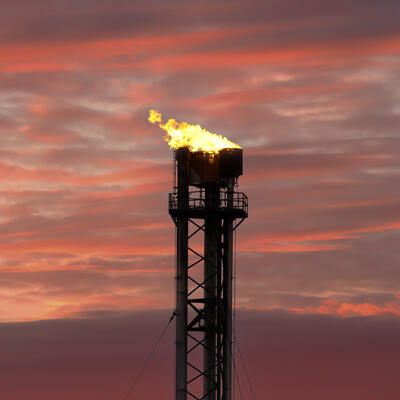
Riley Duren: Yeah, I think the biggest one is what I alluded to earlier with methane intensity standards for natural gas and maybe oil and gas supply chains around the world. If there were to be robust, transparent, trusted, independent measurements of the actual methane emissions and methane intensity of those global supply chains from different suppliers, then those could be fairly significant shifts. Another example maybe closer to home is the Permian Basin. So, the Permian Basin is the largest oil-producing region in the world now; it's in West Texas and Southwest New Mexico. Many of these emissions are quite large and intermittent compared to other parts of the US. And about half of the emissions that we see in the Permian Basin are relatively persistent that is, they're probably there most of the time which implies there may be a leak or a malfunction. And in many cases the operator doesn't know about it and that's based on feedback we get from operators there where we share the data. Another 25% of the emissions that we see when the operators go out and do a follow-up on the ground, they don't find it probably because the emission is very intermittent but the other 25% that they report are so-called expected emissions. Emissions are expected include flaring of gas and you may ask well, why is gas being flared instead of sold. And the reason is in the Permian it seems pretty obvious it's in a state of overproduction more gas is being produced than can be hauled away given limitations in the physical infrastructure things like pipelines. So, you can imagine that if there were additional spotlights and public awareness in civic society and on the part of consumers that there are practices that resulting in a large fraction of wasted gas, we could see changes in what is considered "expected practice" not just fixing the unexpected leaks.
Greg Dalton: Are you helping to extend the life of the oil and gas industry?
Riley Duren: I don’t think that what we're trying to do will directly impact the, how to say this, the transition period of gas. The way I like to or fossil fuel energy and I just say that because my own naïve assessment is it's a fairly complex landscape of incentives and actors and the idea of what we’re doing could prolong or extend something is I'm skeptical of.
Greg Dalton: Or are you enabling because there are some people who say, look, we got to get off fossil fuels as fast as possible. The climate science is scary, we gotta keep it in the ground. And I can see you saying well, you know, we’re cleaning up a dirty industry but I can also see you saying, well, you're enabling them to --
Riley Duren: Well, I guess I have a different perspective. I mean it’s the alternative to not make the measurements and just push to shut it all down and hope for the best. I'm pragmatic in the sense that unfortunately I think that human efforts to mitigate greenhouse gases are not moving as fast as they need to because it's complicated because there are many conflicting forces. And so, my feeling is, and I think this is grounded in the science, is there is an opportunity to get real traction now not in 20,30 years, but the next 5 to 10 years to significantly reduce emissions of methane and other greenhouse gases now and have an immediate climate benefit. So, if we’re talking about action now, we’re talking about the infrastructure that's going to be in place over the next decade. So, I don't think what we’re doing to help pinpoint and expedite repair of methane leaks in any way should impact or dilute efforts to transition to a truly renewable energy source. I think it’s just a pragmatism that someone needs to take action now to clean up what is a very wasteful set of infrastructure and practices right now in the energy sector, in the waste management sector, in the agriculture sector.
Greg Dalton: Pres. Biden has proposed a $16 billion plan to plug abandoned oil wells that are leaking greenhouse gases fixing hundreds of thousands of orphaned wells is favored by Republicans and Democrats. Can Carbon Mapper help guide that program if it is enacted?
Riley Duren: Yeah, I mean I think this was long overdue, and it's critically needed. The Biden administration's recent announcement of cutting emissions, greenhouse gas emissions, by 50% by the end of this decade that's less than eight years now is incredibly ambitious. And I think that one thing that I think is still missing is a commitment and recognition and a commitment to make science-based emissions data part of the solution. I think that we've talked about the current state-of-the-art and the fact that existing monitoring systems are pretty sparse. And so, I think if the US is truly serious about being a climate leader on the international stage, then I think to suggest the need for serious investments and critical climate data infrastructure like the kinds of measurements we’re talking about to operationalize and scale up methods. We just you know, we just don't have time for do overs and missed opportunities because the data is incomplete or bad.
Greg Dalton: On a personal level, what keeps you up at night? Do you really think the technology is gonna solve this?
Riley Duren: What keeps me up at night is the fact that with the data we have the answer is unequivocal that the window for action on climate change is narrowing. I think you know that there is still an opportunity to bend the curve on emissions and avoid you know the worst-case scenarios but that window is rapidly closing. We will not solve everything obviously, with greenhouse gas monitoring but we perceive that Carbon Mapper with this unique partnership will help fill some critical gaps and it will do it quickly. And hopefully government will pick up the ball and run with it in the second half of the decade so that this need not all be on the backs of philanthropy going forward.
Greg Dalton: And on the note of philanthropy, we should note that after we booked you we realized that one of your philanthropic supporters the Lawrence family is also philanthropic supporter of Climate One. Riley Duren, is CEO of Carbon Mapper and a research scientist at the University of Arizona. We’ve been talking about mapping methane, carbon and other climate eating gases. Riley, thanks for coming on Climate One.
Riley Duren: My pleasure, Greg. Nice talking to you.
Greg Dalton: You’ve been listening to Climate One. We’ve been talking about the power and value of maps to help us respond to the climate emergency.
Greg Dalton: To hear more Climate One conversations, subscribe to our podcast on Apple Podcasts, Spotify or wherever you get your pods. Please help us get people talking more about climate by giving us a rating or review. It really does help advance the climate conversation.
Greg Dalton: Brad Marshland is our senior producer; Ariana Brocious is our producer and audio editor. Arnav Gupta is our audio engineer. Our team also includes Steve Fox, Kelli Pennington, and Tyler Reed. Gloria Duffy is CEO of the Commonwealth Club of California, the nonprofit and nonpartisan forum where our program originates. [pause] I’m Greg Dalton.

